

Surveyors and map makers have been trying to pinpoint the elevation of the Black Hills' highest peak since the Custer Expedition passed through in 1874. The elevation of Harney Peak, renamed Black Elk Peak in 2016, was estimated at various times during the 19th century by surveyors using various technologies and techniques.
In 1901, the official elevation was set at 7240 above sea level, but that estimate has been questioned for years. Some doubt the accuracy of the instruments and calculations used in early surveys. Some point to physical changes on the mountain in the past 100-plus years.
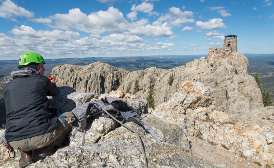
The top of McGillicuddy Peak, a granite outcropping shown to the right of the lookout tower in the photo below, is very close in elevation to the tower peak. Historical photos of the outcropping suggest that rock either eroded or was removed from its top. If historical survey data depended on measurements taken from the outcropping, a change in its elevation would obviously affect subsequent measurements.


Comparisons of McGillicuddy Peak from 1875 and 2016. - Paul Horsted images.

Making the historical view fuzzier is the fact that the mountain's generally-accepted natural high point was partially blasted away to provide a suitable surface for the construction of a lookout tower.

On September 15 and 16, 2016 a team equipped with modern survey technologies, including GPS and other precision devices, measured and calculated the peak's true elevation. The team included two professional surveyors, Jerry Penry, Denton Nebraska, and Kurt Luebke, Missoula, Montana. The team also included noted South Dakota photographer and historian Paul Horsted.
The 2016 survey determined that the elevation of Black Elk Peak, when rounded off to the nearest foot, is 7231 feet. That would be ~10 feet lower than earlier accepted measurements. The surveyors say the measurement satisfies their curiosity and they're confident it's accurate. They say they weren't looking for and don't plan to ask for official recognition of their findings.


OTHER MEDIA
For many more images and a highly-detauked look at the project and survey results, please visit the Web site Harney Peak's Elevation
Paul Horsted’s web site is at paulhorsted.com.